Bowersock Mills and Power Company Low-Head Dam
US-59 Highway
Lawrence, KS
Douglas County
River Mile: 52.4
GPS: Dam – 38.97534, -95.23532. Upstream Portage – 38.97684, -95.23674. Downstream portage – 38.97639, -95.2345.
what3words: Dam – ///coherent.value.clouds. Upstream portage – ///tins.brands.certified. Downstream portage – ///noise.mason.outfit.
THIS IS A DAM AND YOU SHOULD NOT GO OVER IT IN ANY VESSEL. ALL PORTAGE SHOULD BE COMPLETED VIA LAND ON THE NORTH BANK (RIVER LEFT)
Portage Information: The dam is one mile below Burcham Park (river right and not recommended for use) and 1.7 miles below Lawrence Riverfront Park (river left). The dam is owned by the City of Lawrence and operated by Bowersock Mills and Power Company. It is used to generate hydroelectric power and to maintain the pool level for the City of Lawrence drinking water intake, which is upstream. Most paddlers traveling downriver take boats out at Lawrence Riverfront Park above the dam and launch again on the Kansas at the Lawrence Riverfront Park East/8th Street Access Ramp. This requires a shuttle vehicle. A small, steep, gravel kayak/canoe takeout exists just above the dam on river left. Paddlers can take out at that point, portage around the dam and north powerhouse, and put back onto the Kansas River on the east side of the powerhouse. This involves a steep climb to the top of the levee, a 200-yard walk to the put-in location, and a steep descent on gravel back down to river level.
Amenities: No restrooms or lighting. Trash can and informational kiosk on the levee north of the powerhouse.
Paddle Information: The first access is 1.4 miles downstream at the Lawrence Riverfront Park East/8th St. Access Ramp. Boaters may paddle upstream from that access to the area below the dam easily. This location provides excellent fishing opportunities. Boating within 200 yards of the dam is dangerous and not advised.
Game Warden Covering Douglas County: 785-256-1204
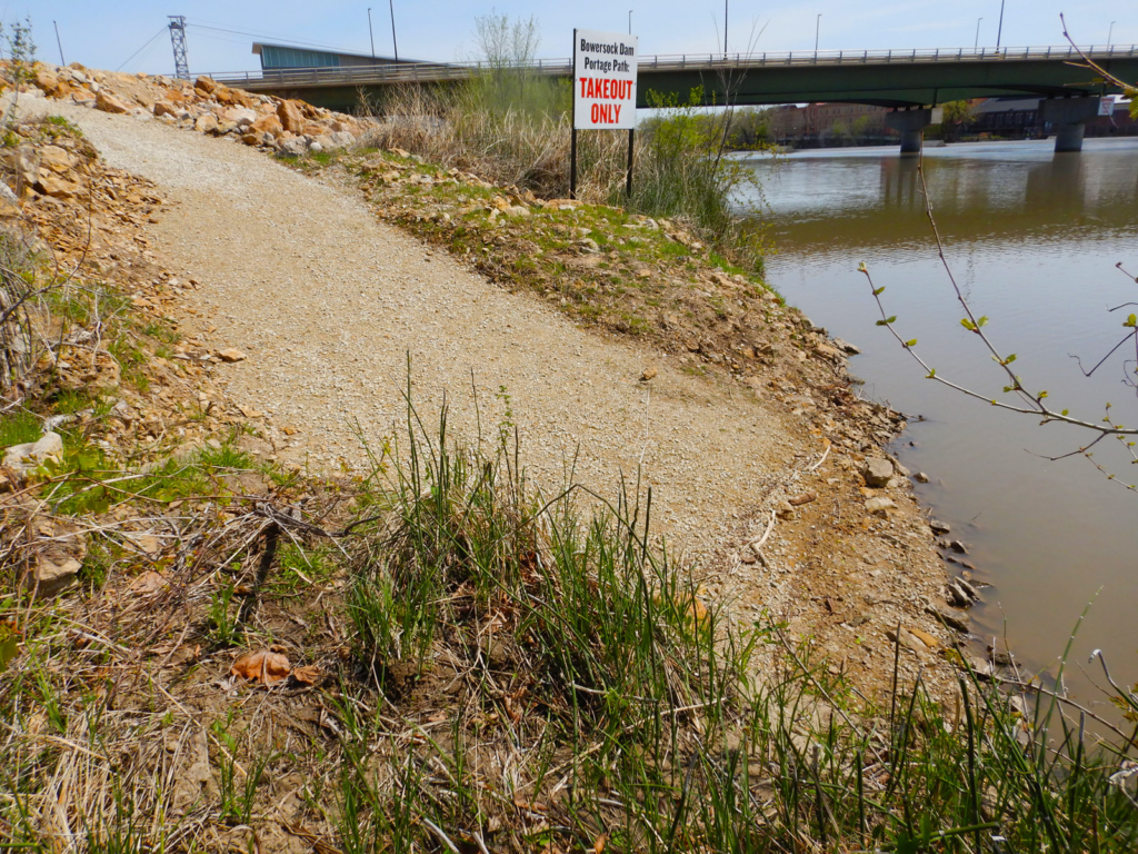
Take out above the dam. 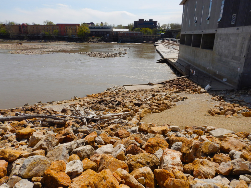
Part of the portage path below the dam. 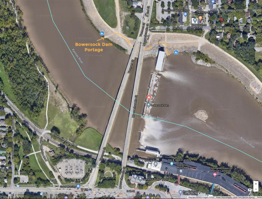
