View Life on the Kaw: The Recreational Kaw in a larger map. Click here for help with our maps.
The Kaw River provides numerous opportunities for recreation. Canoeing, kayaking, hiking, jogging, bicycling and bird watching are all popular on or along the river itself and there are many secondary recreational areas around the 18 reservoirs that control the flow of water into the Kaw’s tributaries.
The Struggle for River Access
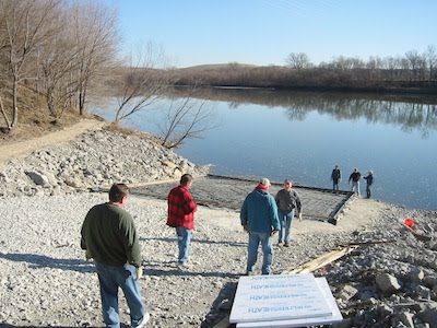
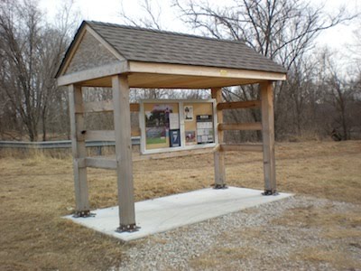
The Kaw is one of three rivers in the state of Kansas that is considered a publicly navigable river. The other two legally navigable rivers are the Arkansas and the Missouri. Other rivers and streams in the state are deemed private property by Kansas law and can only be accessed with the permission of land owners. Although the Kaw has always been open to the public for recreation, for many years public access points were few and far between. The lack of public access was the biggest problem hampering development of recreational tourism on the Kaw. After unsuccessfully persuading the state of Kansas to design and construct boat ramps accessing the Kaw, Friends of the Kaw’s (FOK) Board of Directors decided it would try a different tactic. FOK’s goal was to have public access every ten miles along the 173 miles of the Kaw. Prior to 2003 there were only three access ramps on the Kaw with several more on tributaries. Many times paddlers accessed the Kaw under bridges where they likely found treacherous footing and muddy banks. In 2002, with a goal in place, FOK was awarded a $3,000 grant from the Federation of Fly Fishermen to begin planning and construction of a boat ramp to the Kaw in St. George, KS (just 10 miles east of Manhattan and pictured to right.) Mike Calwell spearheaded this project and assisted the city of St. George in obtaining the necessary permits, getting materials and heavy equipment donated and recruiting volunteers to do the labor. In the spring of 2003 the ramp in St. George was dedicated. The city of St. George continued to develop the adjoining river front park. Today this is a very popular picnic and access spot. By directly involving the community in the planning and construction of the access ramp, not only was the cost considerably less than a State-funded project, but the community took ownership and pride in their new city amenity.
The St. George ramp project became the model for other access ramps and riverfront parks on the Kaw. In 2004 the ramp at Kaw Point in Kansas City, Kansas was constructed and Friends of Kaw Point Park was formed under the umbrella of Friends of the Kaw. Friends of Kaw Point Park is now a separate 501C3 and continues to raised thousands of dollars to develop the Lewis and Clark Historic Park at Kaw Point. In 2005, the state of Kansas joined the effort and constructed an access ramp to the Kaw just northwest of the Lecompton Bridge. In 2006 two communities worked with Friends of the Kaw and ramps and riverfront parks were constructed in both Edwardsville (pictured above) and DeSoto, KS and another ramp was finished under the Highway 177 Bridge in Manhattan. In 2008 we worked with the community of Wamego and added an access ramp to an existing city park just northwest of the Highway 99 Bridge across the Kaw (pictured below.) In 2009 we added an access ramp to Grant Park in Junction City on the Republican River just up stream from the confluence with the Kaw. In 2010 access ramps and a river front park will be added on the north side of the Topeka Water weir (coffer dam) in west Topeka. There will be an access ramp both above and below the dam and public access over the levee and a parking lot will also be added. Currently plans are underway to construct access ramps on the Kaw in Ogden, Kaw River State Park in Topeka, and under the Turner Bridge in Kansas City, KS. Access ramps are also being considered at the Maple Hill and Willard Bridge and between the Cedar Creek and Edwardsville accesses in Shawnee. Wahoo – our goal is close to being met!
FOK has also worked with WaterOne of Johnson County and the City of Topeka Water Division and portages around the existing coffer dams near the respective water intakes on the Kaw have been consrtucted. Bowersock Mills and Power Company will improve the portage around Bowersock Dam in Lawrence when and additional hydrological power plant is added to the north bank in the next several years.
Friends of the Kaw’s success on this project has been driven by Mike Calwell, Board Member. Mike’s expertise has also been recognized by Kansas Department of Wildlife and Parks (KDWP) – another significant partner in the construction of Kaw River access. Friends of the Kaw would like to thank both Mike and KDPW for their dedication in planning and building access ramps on the Kaw River. Friends of the Kaw appreciates all the donations of supplies, expertise and labor by individuals, businesses and city and county governments to make this project a reality.
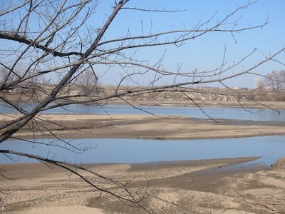
Most of the land adjacent to the river is privately owned, and most landowners don’t want strangers on or crossing their property. Because there are no public swimming beaches on the Kaw, it is not designated for swimming or waterskiing. The Kaw is designated by Kansas Department of Health and Environment as Primary Class B, which allows for kayaking and canoeing as well as wading. The water of the Kaw is generally suitable for these activities except after a rain when contaminated runoff from agriculture and municipalities causes polluted conditions. A rule of thumb to avoid getting sick after recreating on the Kaw or in any recreational waters, is to wash or disinfect your hands, particularly before you eat a snack or meal.
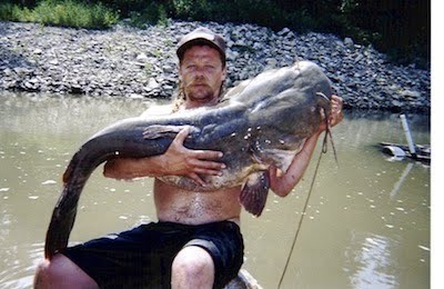
The Kaw is known for its world-class catfishing waters, particularly for flathead catfish, although channel and blue catfish are commonly caught, too. Though the sport fishing in the river can be exciting, the state recommends against eating many fish taken from the Kaw between Lawrence and Eudora because of the high levels of PCBs found in the tissue of the fish.
Safety should be paramount for anyone who wants to play on the Kaw. Although the river is generally slow-moving and shallow, one needs to be cautious of fast currents and migrating sandbars, particularly when water is being released from reservoirs or after a heavy rain. When boaters are on the river, they should keep an eye out for submerged objects and always steer clear of strainers (tree trunks or rocks that have caught debris). Never go to or in the river alone, and always wear a life jacket when boating or wading.
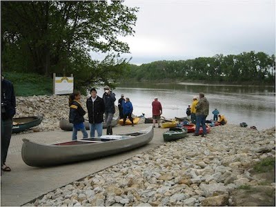
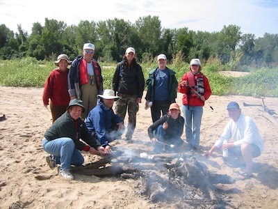
One of the best ways to enjoy the Kaw and to learn more about it is to participate in a FOK float trip. Private groups of 16 to 24 people can organize a float trip in canoes and kayaks for specific 5- or 10-mile stretches of river. Float trips include a hot dog and marshmallow roast (pictured on right) and a “Sandbar Seminar” to learn more about the Kaw.
Kaw Point
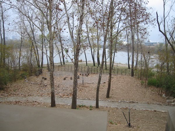
In April of 2002, Friends of the Kaw hosted Robert Kennedy, Jr. (pictured on right) for a press conference and the launching of the Kansas Riverkeeper patrol boat at the then-undeveloped Kaw Point area, where the Kaw flows into the Missouri River, and where the Lewis and Clark expedition camped for three days in June 1804. Robert Kennedy, Jr. is the founder and current CEO of the Waterkeeper Alliance, an international water protection organization with over 160 members, including Friends of the Kaw. When asked by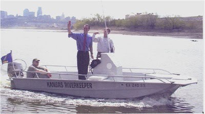 the press what he thought of the area, Mr. Kennedy said, “I see a squandered resource.” This statement helped foster the transformation of Kaw Point from a junk yard to one of the most beautiful parks in the Midwest. The area today offers walking trails (pictured below), an educational pavilion, and a boat launch.
Johnson County
Mill Creek Streamway Park, the largest of Johnson County’s streamway parks, has 17 miles of paved trails for walking or bicycling. It extends from the Kansas River to Olathe. In 1986, voters approved the streamway approach to parks, in which land along streams is acquired for natural areas. Streamway parks serve a number of useful purposes. They provide quiet, shady places in picturesque areas where people can walk or ride bicycles. They offer uninterrupted stretches of habitat for animals that live in riparian (or water-bank) areas or along the edges of these areas, so that the animals can move about freely without having to risk their lives in traffic. Also, riparian areas serve as sponges that soak up extra rainfall and deter flooding. If they are paved over, flooding downstream worsens. By preserving the floodplain as parkland, flood damage is minimized. A low-impact streamway park such as this one, with nothing more than a bike path and occasional benches, lets water rise and fall at nature’s whim, with nothing harmed.
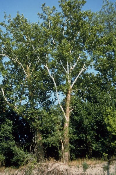
At the northern border of Johnson County on the Mill Creek Streamway Park is a bridge that leads to Nelson Island. The island is named for Cleggie Nelson, who ran a speakeasy here during Prohibition, but then spent the rest of his life as a hermit. When Nelson took title to the island in 1920, it was 27 acres and was reached by a hanging bridge. Today, the powerful force of the river has eroded the sandy banks and diminished the island to half its former size. In the fall of 1998, the flooding Kaw took a big chunk of the island, slicing off a quarter mile of paved path. The island provides an excellent example of the woods that are typical of riparian areas all along the Kaw. Big cottonwood and sycamore trees (pictured on left), with a tangled undergrowth of shrubs and vines, line the sandy banks of the river and serve as perches for the bald eagles that winter here. A biological survey a few years ago found 75 species of plants. The trail cuts through the undergrowth, providing a shady place to walk and an opportunity to get close to the river. Unlike the peaceful trail in Shawnee Mission Park, south of here along Mill Creek, this area endures a constant din of urban activity. Cars and trucks roar by on Interstate 435 as it crosses the Kaw, the sand operation across the river adds its drone, and, to the south, garbage trucks and giant earth movers beep and rumble in the Johnson County landfill. Yet wildlife still finds a home here, a testament to the resilience of nature.
Along the banks of the river or in nearby wetlands, are bald eagles (especially in winter), hawks, great blue herons, American avocets and greater yellowlegs, as well as many kinds of migratory waterfowl and songbirds in spring and fall. Painted turtles perch on logs soaking up sun. Raccoons, coyotes, muskrats, northern water snakes, and beavers are frequent visitors or residents. On agricultural lands near the river, live deer, badgers, owls, meadowlarks, Great Plains toads, and rat snakes. The state fishing lakes and federal reservoirs attract an astounding diversity of animals, some that stay year-round, some that migrate here in winter, others that just pass through. Bobcats are widespread, though seldom seen, in many areas near the Kaw.
Lawrence, Lecompton, and Clinton Lake
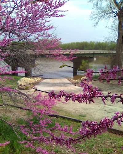
In Lawrence, a path on top of the levee attracts hikers, joggers and cyclists. There are also some off-road trails for mountain bikers. The stretch of river from Lawrence to Lecompton (Rising Sun Access just northwest of Lecompton Bridge pictured on left) offers some of the best places in the state to see bald eagles in winter, when they are drawn to the open water below the Bowersock Dam. Bald eagles can be seen year-round around Clinton and Perry lakes. Kansas has become home to at least 14 breeding pairs that have successfully fledged more than 123 eaglets in the past decade. The first of those pairs built a nest on Clinton Lake in 1989. Despite the fact that the female disappeared during incubation, and the male raised the birds alone, two eaglets were fledged that year. One of them returned to Kansas in 1993 and nested at Hillsdale Lake in Miami County, and the other returned in 1994 and nested at Perry Lake. Every year, a pair of eagles has come back to this area and successfully raised young—usually three eaglets, which is more than the national average. One is likely to see eagles around the south end of Clinton Lake from early November to mid-July. The eagle lays eggs—about the size of a big chicken egg—between late January and March. The male and female sit on them for a little over a month, until they hatch. Then the adults care for the young for 70 to 80 days before the offspring learn to fly. By then, the eaglets have reached 95% of their adult size, and that 6-foot nest, which seemed huge when there were three chicken-sized eggs in it, will seem a little cramped with five birds that stand 3 feet tall from head to tail and that have wingspans of 7 feet. The young eagles will roost at the nest tree for about a month after fledging. The pair that nests on the Wakarusa arm of Clinton Lake usually leave the lake in summer, presumably to find cooler weather in the north or west. Some of the other nesting pairs in the state do stay year-round.
The comings and goings of the Clinton eagles are fairly well documented because the U.S. Fish and Wildlife Service bands the birds and has even put radio transmitters on some of them. How do they manage to put a leg band on a bird as big and ferocious as a bald eagle? The preferred method is to do it when the birds are 6 weeks old, about 8 to 10 pounds. After the parents have flown off the nest, a boat pulls up to the tree, and a tree climber scales up to the nest. Each bird is put in a gunny sack and lowered to the biologists waiting below. Even at that age, the eaglets are a handful, but the biologists attach leg bands, measure and photograph the birds, and return them to the nest in about 30 minutes. Contrary to popular belief, the parents will not abandon the baby birds if they smell humans on them. Eagles, like most birds, don’t have much in the way of olfactory sense.
Perry Lake and Topeka
There’s great hiking around Perry Lake on a 30-mile National Recreation Trail that winds up and down the hills and valleys on the east side of the lake. It traverses many kinds of landscapes, including prairies, farm fields, upland woodlands, intermittent streams, and riparian areas. The Perry Lake trail was established by the Kansas Trails Council.
Another hiking trail is in Topeka behind the governor’s mansion, called Cedar Crest. Flat, paved parts of the trail run next to Interstate 70 and are pretty noisy, but there is some lovely woodland walking which hardly seems near the edge of the city. Park on the west side of the governor’s mansion to find the trailhead for the wooded area. The trail is interesting botanically because of its seamless transition from upland woodlands, with its complex of oaks and hickories, to the riparian area along the streams. Nearby, on the former Menninger Clinic grounds, the state is developing the 76-acre Kaw River State Park (pictured on left).
Tuttle Creek Reservoir and Manhattan
The catfish are legendary at the Rocky Ford area below Tuttle Creek dam. Rocky Ford was the site of a grist mill and later a hydroelectric plant on the Big Blue River, a tributary of the Kaw, as early as the 1870s. Newspaper accounts from 1870 report on people who caught up to 400 pounds of fish in one trip. Rocky Ford now is just below the Tuttle Creek dam, so the water level can rise suddenly when water is released upstream. A siren is supposed to sound before that happens, but visitors should be aware that any sudden increase in water level means they should head back to higher ground.
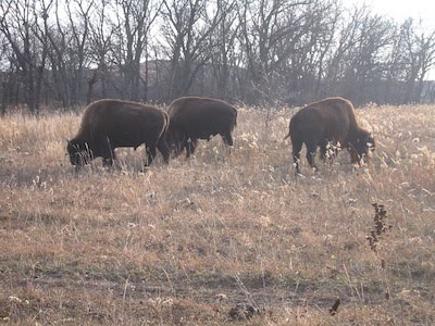
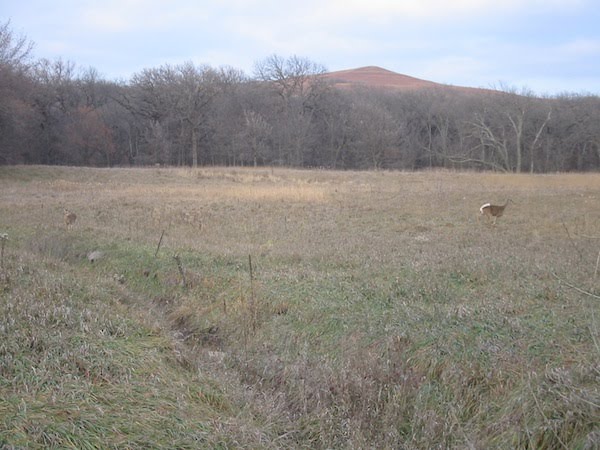
South of Manhattan lies the jewel of the Flint Hills, the Konza Prairie. To get there, cross the Kansas River and turn west onto McDowell Creek Road. The road runs between the Kaw River and the hills, and it feels almost as though you are in two different places at once. On the right is the broad, flat floodplain with its white frame farmhouses surrounded by lush fields of corn and wheat, a typical Eastern farm scene. On the left, are stone ranch houses, stone barns, and stone fences tucked into the hills, cattle grazing around them, the image of the West. Pictured below are buffalos grazing on the Konza Prairie and also deer on the Konza Prairie.
Konza Prairie Research Natural Area is 8,600 acres of virgin tallgrass prairie, which means it has never been plowed. It was once part of the 10,000-acre Dewey Ranch, purchased in 1872 by C.P. Dewey, a Chicago land speculator. C.P. Dewey and his son, Chauncy, kept adding to their empire in this area, particularly after a savage blizzard in 1886 forced many cattle ranchers to sell their land cheap. By 1926, the Deweys owned 30 large parcels of Flint Hills land. But their cattle enterprises, like those of so many whose land they had bought, eventually failed,and the mortgage holder repossessed the Dewey Ranch in 1930. Two years later, George Davis purchased it, bringing his acreage in Kansas up to 70,000 and making him the largest landowner in the state. Davis also owned the Z Bar Ranch, which includes the 10,984-acre parcel near Strong City that is now the Tallgrass Prairie National Preserve. He owned an even larger parcel in southwest Kansas that media magnate Ted Turner purchased in 1999. The Nature Conservancy acquired the Konza in 1977 and turned it over to Kansas State University for management. For many years, the Konza was off limits to everyone but the scientists who conduct research here, but today public trails go through stream and prairie habitats. Fourteen miles of hiking trails, designed for walks of 3, 5 or 6 miles, are open daily to the public. A brochure at the trailhead introduces the grasses and other plants that make up the tallgrass prairie and gallery forests along the streams. Go quietly, and you may see wildlife in the first “edge” area of the trail, where a cultivated field meets the riparian area along the stream. Turkeys and deer are common visitors here. The first part of the hike has a steep hill that may be taxing, but it is well worth the effort. At the ridge, a nearly pristine landscape stretches as far as the eye can see.
Milford Lake
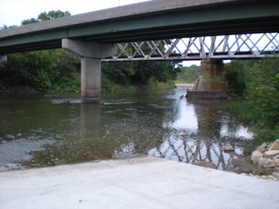
Milford Lake, near Junction City, is another Corps of Engineers reservoir in the Kansas River basin. Milford is the largest lake in the state, covering 15,000 acres in its multipurpose pool, more than twice that in its flood-control pool. Besides the usual lake attractions, Milford has a fish hatchery, a nature center, and a new hiking trail along the Republican River, a tributary of the Kaw. In 2009 Friends of the Kaw assisted the city of Junction City construct a new access ramp to the Republican River just before the confluence of the Kaw (pictured on left.)

