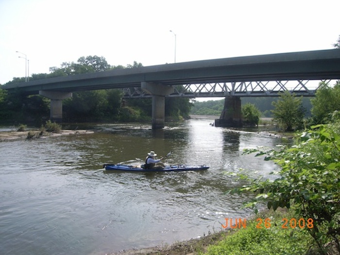
The Kaw near Junction City
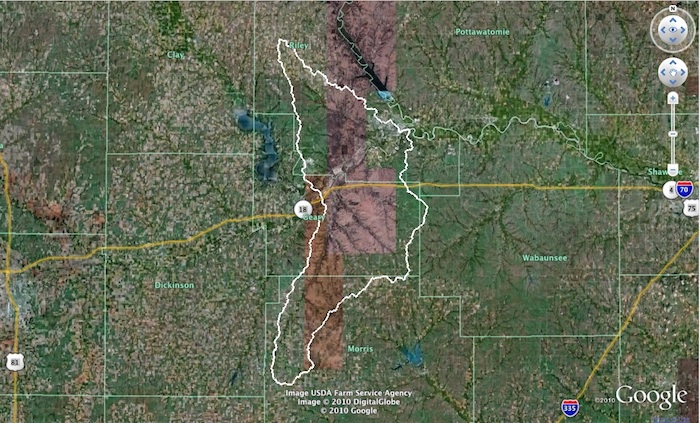
View Geary County in a larger map. Click here for help with maps.
Map Key: Geary County is outlined in purple and the portion of the Upper Kansas River Watershed in Geary County is shaded in red
Population (2000): 62,843
Square miles: 610
Population density: 103 per sq mi
County History
Detailed information is available from the River Inventory for
Geary County
View Kansas River Inventory-Geary County in a larger map. Click here for help with maps.
Junction City – River Mile 173
Junction City government website
Population size (2008): 20,671
Square miles: 7.55
Population density: 2,738 people per sq mi
Upper Kansas River Watershed HUC 10270101
Boat access points: Junction City, Grant Park on the Republican River near river mile 17
Bridges over Kaw: Henry Bridge in Fort Riley at river mile171.5
Dredge sites/off river pit mines: There are no in-river dredge sites or off river pit mines near the Kaw in Geary County.
Wastewater treatment: Junction City WWTP (Pop. served: 15,662); Junction City SW WWTP (Pop. served: 2,000)
Water sources: Groundwater from the Republican River alluvial aquifer (water treatment information)
Water Discharge Permits
Click on markers for permit data from EPA MyEnvironment