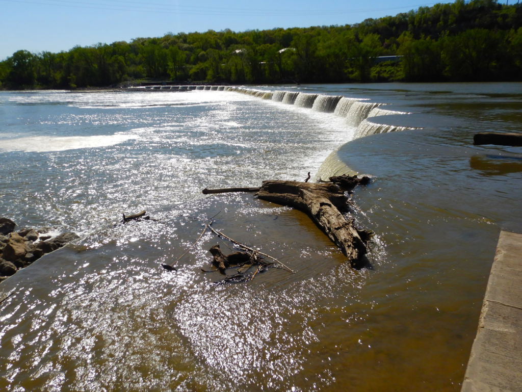
WaterOne Low-Head Dam (also known as the WaterOne Weir)
Near Interstate 435 and Woodend Road
Kansas City, KS
Wyandotte County
THIS IS A LOW-HEAD DAM AND YOU SHOULD NOT GO OVER IT IN ANY VESSEL. ALL PORTAGE SHOULD BE DONE VIA LAND ON THE NORTH BANK (RIVER LEFT)
River Mile: 14.8
GPS: 39.04685, -94.78718 (for the dam, not the portage)
what3words: ///flame.pollen.outpatient (for the dam, not the portage)
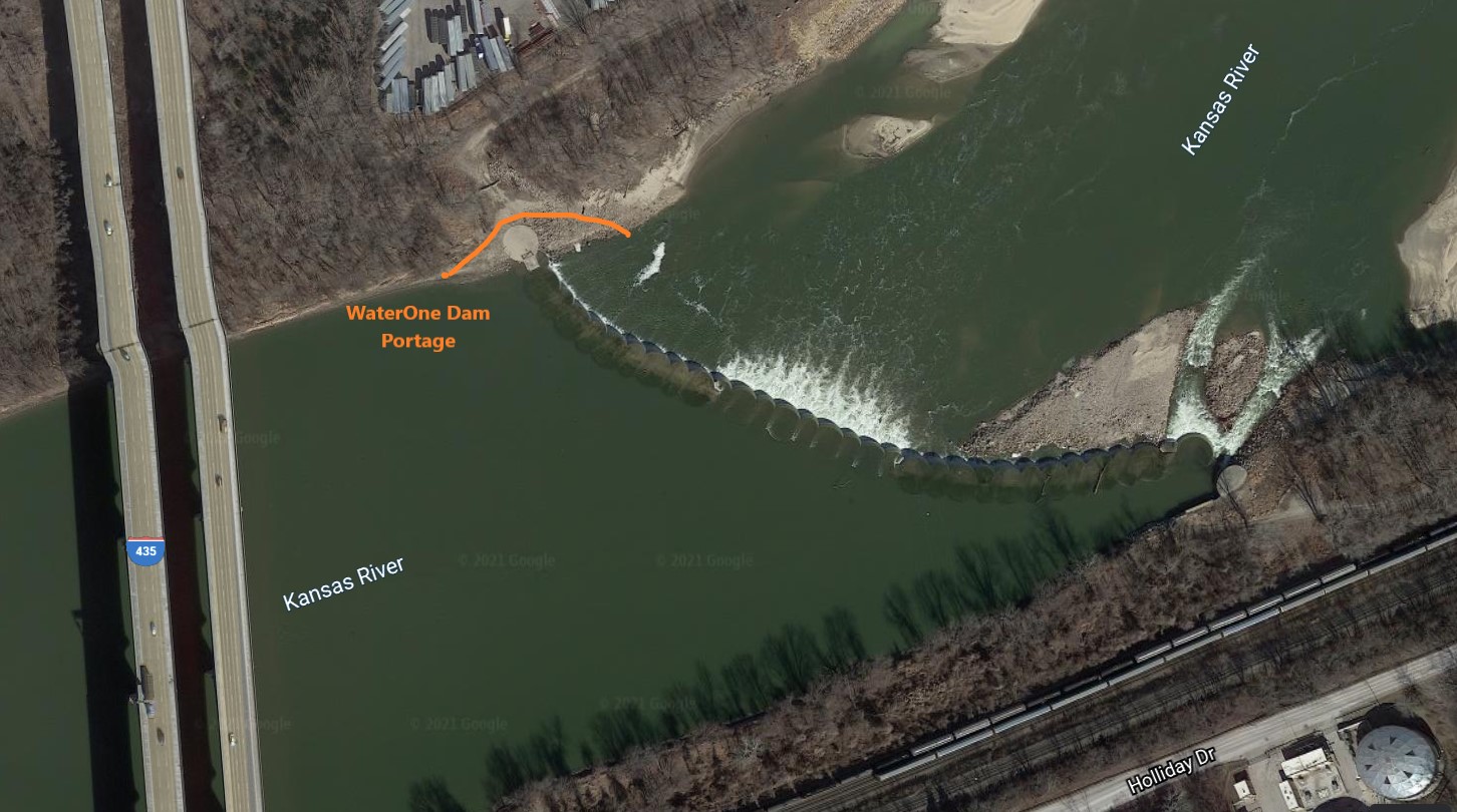
Portage Access: River Left
This is a rough, 100+ yard portage that requires carrying boats over large, loose rocks that provide precarious footing. (Wheels and carts are not helpful.) At low water levels, you can take out just above the dam onto the stable rock bank; at high flows when the water is flowing over the dam, you must take out onto a slick mud bank safely upstream.
Access Information: AVOID THE LOW WATER NOTCH ON RIVER RIGHT NEAR THE SOUTH BANK. Do not attempt to go over the dam or through the water notch. Portage this dam on river left only. There is no other portage access. Currents in this area are dangerous, so use caution.
Paddle Information: The next downstream access is the Turner Bridge Access Ramp at river mile 9.2.
Game Warden Covering Wyandotte County: 785-256-1206
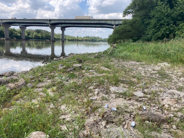
Portage path above the dam. 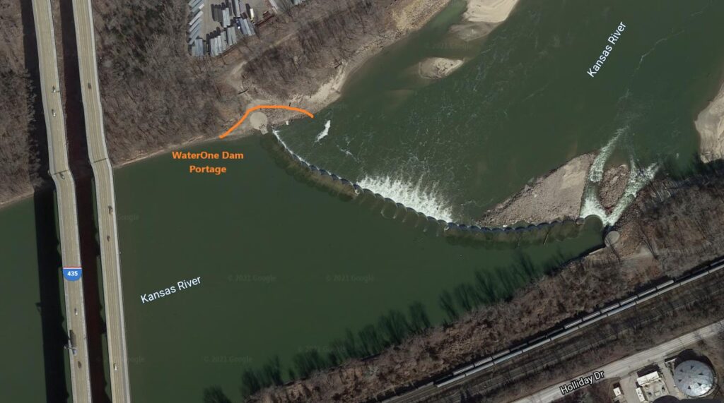