Unincorporated JoCo

JoCo Stormwater Management Tour

One of the best ways to learn more about stormwater Best Management Practices is to go see them for yourself– and the next best way is the Riverkeeper’s BMP tour below.

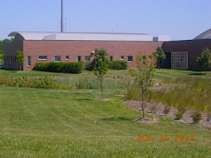
Many BMPs are in publicly accessible locations around Johnson County, making them easy to view. Most cities in JoCo have BMPs, but Lenexa is the leader with over 100. In fact, every new development in Lenexa has a BMP to mitigate the additional runoff caused by buildings, parking lots, and other impermeable surfaces on the site. Many of these BMPs are part of the city’s Rain to Recreation program, which provides hiking trails, fishing, boating, and other recreational opportunities at the BMP. They also enhance plant and wildlife conservation, making them ideal places for bird watchers and outdoor enthusiasts. Lenexa’s innovative approach to stormwater management provides great places to view nature close to home.

Lake Lenexa
Mize Lake
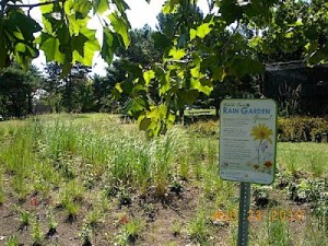
Rain garden
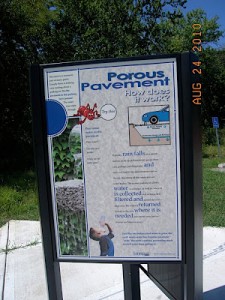
Porous pavement parking lot


DeSoto Rain Garden

Friends of the Kaw has embarked on a new adventure– we are building a rain garden at the De Soto Riverfest Park boat ramp. Needless to say, this is teaching us a lot about managing stormwater run-off from a hands-on perspective.

Our guide is Ryan Domnick of Low Maintenance Landscape in Lawrence. Ryan told us that rain gardens are a great way to put run-off from parking lots to good use. Using run-off to water a garden rather than polluting our river makes a lot of sense. He explained to us that rain gardens not only reduce the quantity of run-off from impervious surfaces, they also improve water quality.

While water can’t soak into an asphalt or concrete covered surface, it can soak into a lawn…but a lawn can’t soak it all up. What’s different about a rain garden is the top soil is deeper and less compacted, and the plants have really deep roots. As a result, rain gardens soak up thirty percent more water than a typical lawn. But that’s not all…the plants and soil organisms actually help to remove nutrients and other pollutants from the water. The water that percolates out of the rain garden is better for the environment, and our beautiful rain garden will actually help the river while it is delighting us with flowers, butterflies, birds, and wildlife.

We asked Ryan about some of the things we had heard about rain gardens– and he assured us that mosquitoes and weeds are not a problem. If a rain garden is properly designed it drains too fast for mosquitoes to breed (rain gardens are not “swamps” in any sense of the word). And rain gardens can be as neat and attractive as you want– they don’t have to have that “wild” look if you don’t want it. Weeds are controlled by maintaining a think layer of eastern red cedar mulch and some periodic weeding.

Rain gardens sound like a great idea. They reduce the chance that run-off will flood your basement, they are really pretty, and they help the river. Watch our rain garden grow, and check out what we are learning about the entire process of creating a rain garden of our very own.

We want to thank the Johnson County Stormwater Program for funding this project and Low Maintenance Landscape, Inc. for designing and building the project.

Developer Information and Resources

Johnson County requires developers to follow the Best Management Practices of the APWA/MARC BMP Manual (henceforth APWA/MARC). This means that the basic goal for all developments is to maintain pre-development peak flows, runoff volumes, and water quality. In other words, development should maintain the velocity and quantity of runoff and the amount of pollutants leaving the site, unless the effects are fully considered and documented in the design or unless site conditions apply that require more stringent measures. (APWA/MARC p. ES-1)

In addition to the APWA/MARC BMP Manual, guidance for countywide ordinances can be found on the JoCo Stormwater Management Program website for municipalities, and specific guidance is also given for unincorporated parts of  the county. Specific local ordinances, cost sharing, and other programs have been developed for the following municipalities:


Here we provide a brief overview of some of the more common BMP’s that are used in Johnson County to achieve these goals. You can also take a virtual tour of BMP’s in Johnson County and of the Green Infrastructure in Lenexa.

BMPs for Housing and Retail Developments


porouspavementsignPervious Pavements

Pervious pavements allows water to infiltrate the surface layer and enter into a high-void, aggregate, sub-base ayer. The captured water is stored in the sub-base layer until it either infiltrates the underlying soil strata or is routed through an under-drain system to a conventional stormwater conveyance system. (APWA/MARC p. 2-2)

Pervious pavements are an example of structural BMP’s that reduce runoff at the source. There are many different kinds, including interlocking pavers that allow infiltration in spaces filled with pea gravel between the pavers; lattice work with vegetation; and concrete and asphalt that are made to allow water to seep through the surface. In all cases the pavement is underlain with several porous strata that can hold the water while it slowly moves out of the system. You can visit a demonstration project at the Coon Creek Trailhead in Lenexa and learn more about pervious pavement.

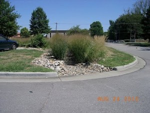
bioretention2Bioretention Basins

A common structural BMP for retail and business developments, bioretention basins are small engineered and landscaped basins intended to provide water quality management by filtering stormwater runoff before it is released into stormdrain systems. (APWA/MARC p. 2-1) They are ideal for use in median strips, parking lot islands, and landscaped swales, and are best distributed throughout the development to treat runoff as close to the source as possible.

Effective bioretention cells typically are fairly small, taking up an area equal to about 5% of the total impervious surface of the development. They are easily designed and planned as part of the site’s required open space. In practice, these units are maintained in the same manner as decorative landscaping, which helps to minimize maintenance costs and increase value-added benefits. Implementing this one standardized practice in all developments can minimize design, inspection, and maintenance costs. (APWA/MARC p. 5-2)


bioswaleBioswales

A swale is a depressed area used for stormwater conveyance and/or short term storage (think of it as a modified ditch). The fact that runoff is conveyed through the system rather than being retained within it is what distinguishes a swale from a retention basin or rain garden.

There are several kinds of swales used for stormwater runoff management. A Bioswale is an open vegetated channel with an engineered soil matrix and underdrain system designed to filter the runoff (see photo on left). A Native Vegetation Swale consists of Native grasses and forbes planted in a swale to reduce the velocity of the runoff and promote infiltration. A Turf Grass Swale is planted with turf grass and meant to be used as a substitute for closed drainage systems. Finally, a Wetland Swale is an open vegetated channel without underdrains or a soil matrix designed to filter runoff and remain wet between rain events. (APWA/MARC p. 2-3)


raingardenRain Gardens

Rain gardens are typically used for small areas (less than an acre) and are a good BMP for single family homes. (APWAMARC p. 2-3) Rain gardens can help manage outflow from downspouts or runoff from turfgrass lawns, patios, and driveways. Like Bioretention Basins and Bioswales, they are considered structural BMP’s used for source control.

Rain gardens consist of a depression to retain the runoff, a deep layer of soil with good infiltration properties, and deep rooting plants that are tolerant of periodic high soil moisture. They can significantly reduce excess nutrients and sediment in runoff and, if they are sufficient in number, can be an important component of reducing runoff in a watershed. Typically the home owner will maintain rain gardens on their property. When they are first installed (the one on the left is newly planted), they should be weeded weekly. Never use fertilizer on or near a rain garden. After plants are well established, leave the dead vegetation standing over the winter to provide bird habitat, then remove it in the spring by mowing or burning (if allowed). (APWA/MARC pp. 8-1 to 8-4)  Click here for information about building Rain Gardens.


vegwetlandVegetated Wetlands

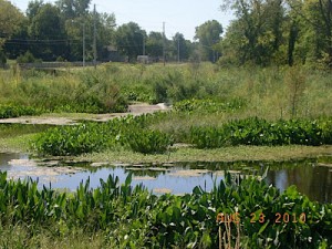
A wetland is area that is permanently wet or periodically flooded by surface or groundwater and has developed hydric soil properties that support vegetation growth under saturated soil conditions. It may have been engineered with adequate capacity to detain large storm flows. (APWA/MARC p. 2-1)

A distinction must be made between using a constructed wetland for stormwater management and diverting stormwater into a natural wetland; natural wetlands and streams are protected by the Clean Water Act and activities that alter or fill them are regulated by state and federal agencies (for an overview go to the KDHE website). Natural wetlands should be protected because they are important for reducing flooding and improving water quality, as well as providing crucial habitat for many species of plants and animals. Constructed wetlands, in contrast, are used for receiving and pretreating stormwater runoff from developments.

An Extended Detention Wetland is a constructed basin that has a permanent pool of water throughout the growing season. Runoff is detained for a 40-hour period. They are relatively shallow (approximately 18 inches maximum depth) and are heavily vegetated. Both the rooted plants and microbial processes in the soil remove nutrients and many types of pollutants, resulting in a significant improvement in water quality. Extended Detention Wetlands are among the most effective stormwater practices in terms of pollutant removal, and they also offer aesthetic value, especially for their wildlife habitat. (APWA/MARC p. 8-40)


ripariansmallRiparian Corridors and Stream Buffers

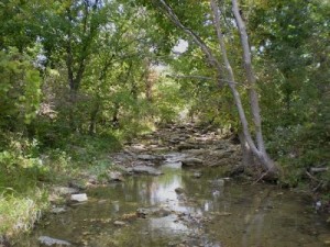
Riparian corridors are trips of herbaceous and woody vegetation located parallel to perennial and intermittent streams and adjacent to open bodies of water. They capture sediment and other pollutants in surface runoff water before these can enter the adjoining surface waterbody. A stream buffer is an area defined by regulatory agencies or municipalities for the protection of riparian corridors and
floodplains. (APWA/MARC p. 2-3)

An undisturbed riparian corridor in northeastern Kansas will be heavily vegetated, typically with an under layer of grasses and forbs, an intermediate layer of bushes and young trees, and a mixed forest with trees of different ages and species. Riparian corridors are an integral part of the stream system. They provide shade that lowers water temperature; leaf fall and insects that form an important component of the stream food web; deep roots that hold soil in place and absorb nutrients and other pollutants; and dense vegetation that slows the overland flow of runoff, allowing suspended sediment to settle out before reaching the stream. Riparian corridors with native vegetation not only provide many important ecosystem services, they can also provide beautiful locations for recreational trails, as can be seen in Kill Creek Park and Mill Creek Streamway Park

Preserving existing vegetation along streambanks is a non-structural BMP that can be a very cost effective way of reducing both pollution from stormwater runoff and flood hazard to residential and commercial developments. APWA recommends creating community-wide stream buffer systems through the enactment of stream setback ordinances. For example, preserving a 100-foot riparian buffer in a watershed of 5,000 acres (less than 5% of the land in the watershed) can yield disproportionate benefits; not only does it reduce adverse impacts from stormwater runoff, it can also provide significant financial returns to communities by increasing home values through the aesthetic and recreational opportunities that it provides. (APWA/MARC pp. 7-12 to 7-14) You can find the EPA model setback ordinance as well as the ordinances adopted by the City of Lenexa and Overland Park on the MARC website.


MizeLakeTreatment Train

The treatment train refers to the series of BMPs (or other treatments) used to achieve biological and physical treatment efficiencies necessary for removing pollutants from stormwater or other wastewater flows. (APWA/MARC p. 2-3)

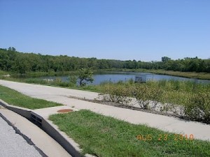
Mize Lake is an example of a complex series of structural BMPs used for managing runoff from a large area. It is a seven-acre lake with three sediment forebays, three wetlands, and two bioretention cells (click here for more information).

Many Treatment Trains combine both structural and non-structural BMP’s to increase infiltration and successively treat the water as it passes through the system. Large scale systems like this are used to manage stormwater that is in excess of that which is captured and treated at the source by BMP’s like the Bioswales or Bioretention Basins described above. (APWA/MARC 3-4)

The City of Lenexa has developed a Rain to Recreation program that utilizes stormwater management BMP’s like Mize Lake and Lake Lenexa as parks and recreational facilities. By preserving Native vegetation, providing Riparian Buffers and other non-structural approaches these BMP Treatment Trains/recreational facilities maintain a natural character that provides both aesthetic value and important wildlife habitat.


silt fenceConstruction Site BMP’s

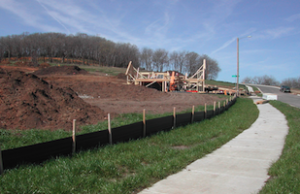
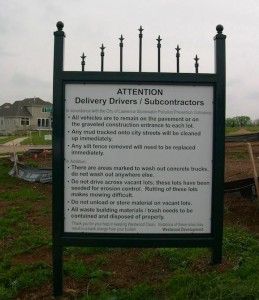
Best Management Practices during construction not only significantly reduce the negative impacts of runoff during the construction phase, but can also have long-lasting positive effects on post-construction stormwater management. Obvious design elements like the practices listed above are all important, but so is the way in which soil and vegetation are treated during the construction process. Plants that are native to Kansas typically have deep roots that help stormwater penetrate deeply into the soil and are well adapted to the Kansas climate, allowing them to thrive without fertilizer, pesticides or regular watering. Maintaining native vegetation, especially around waterways, can be a cost effective way to reduce runoff. Soil preservation and restoration measures are also important; compacted soils have poor infiltration capacity. In contrast, soils that have developed in areas with native  vegetation have deep, humus-rich layers with excellent infiltration capacity. Wherever possible these soils should be preserved or restored. (APWA / MARC 5-39 to 5-40)


Westwood sign