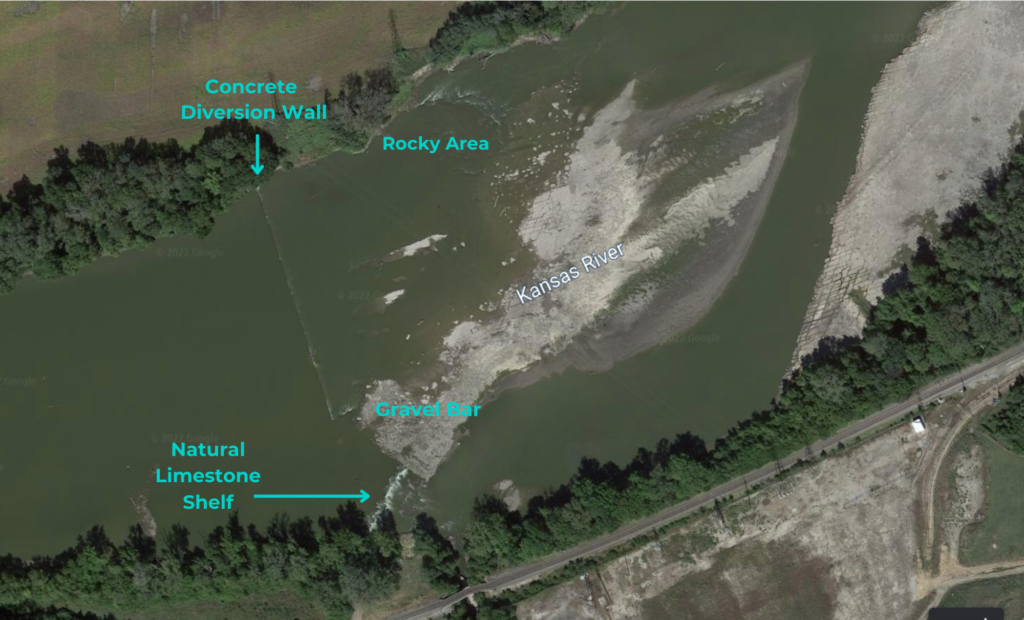
Approximately 1 mile east of the Seward Avenue/Fool’s Landing access ramp.
Shawnee County
River Mile: 76
GPS: 39.05499, -95.57253
what3words: ///soundtrack.slugs.tilt
The low-head dam at the former Tecumseh Power Plant is one mile downstream from the Seward Avenue/Fools Landing access ramp east of Topeka. THIS AREA OF THE RIVER IS NOT RECOMMENDED FOR NOVICE PADDLERS. This is a challenging area to navigate and should only be paddled by those with extensive river experience.
This diversion structure is a low wall that spans 2/3 of the river from the left (north) bank, shown in the picture below. It was built to divert the river into an intake building on river right that is no longer present. Paddlers should always approach this area slowly to assess river conditions and options for passage. The structure is barely visible under most river conditions.
We suggest that paddlers utilize Google Earth tools to review this section of the river before attempting. Paddlers should always approach this area slowly to access the passage as the wall structure is barely visible in most situations. This area is not suitable for novice paddlers under any river conditions.
Passage is not advisable for motorized boats. There are no river bank portages nor is there any public access to roads in this location.
Game Warden Covering Shawnee County: 785-230-4434

