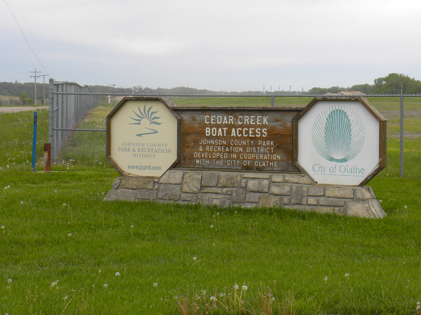
CLOSED: Cedar Creek Access Park
The Cedar Creek Access Ramp is current closed due to storm damage. There is not an estimated time for repairs, but we will update once we know more.
Access Road (via Gardner Road)
DeSoto, KS
Johnson County
River Mile: 26.1
GPS: 38.98202, -94.92268
what3words: ///loaf.pilots.evaporates
Access Ramp: River Left
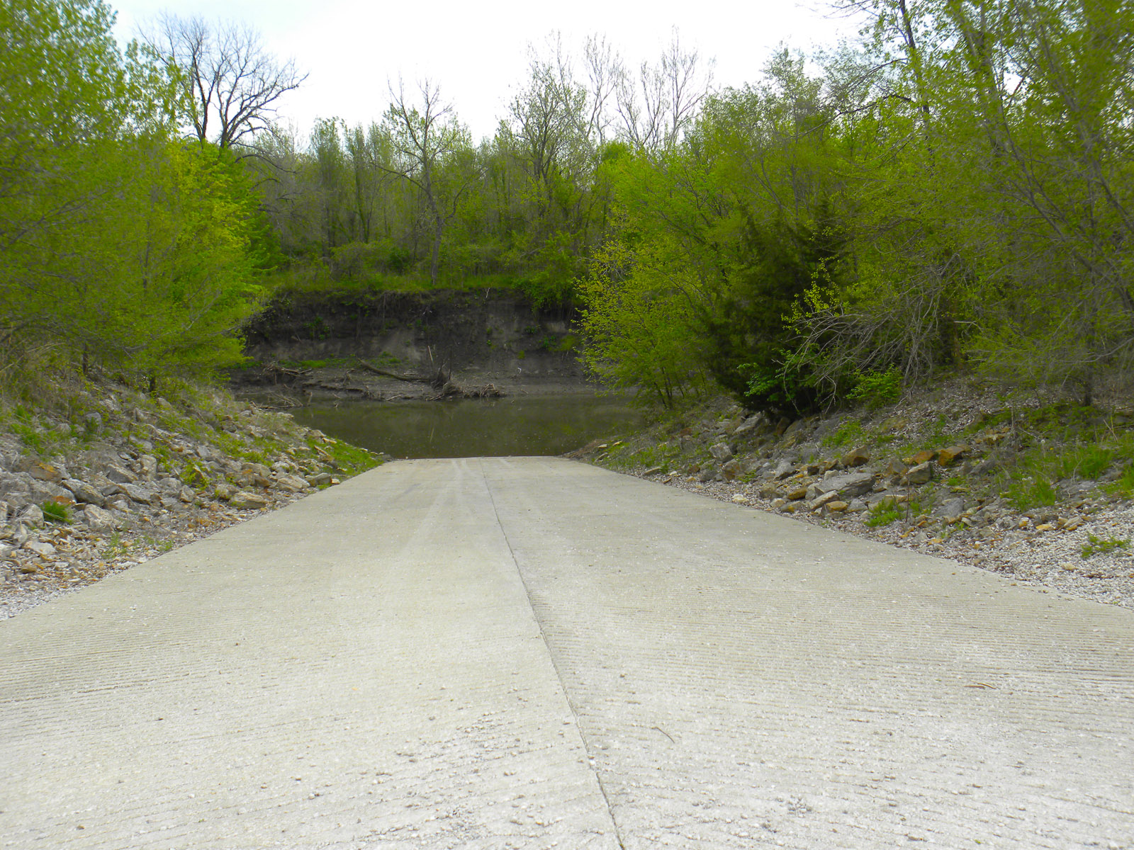
The access ramp is on Cedar Creek. The Kansas River is about 200 yards downstream.
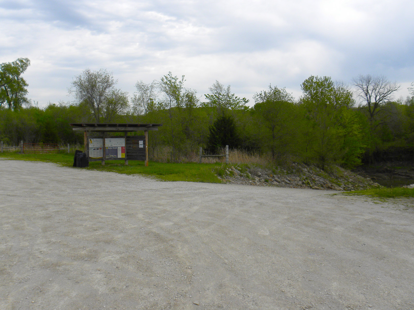
Directions: Located approximately 3 miles east of the town of De Soto off of 83rd Street. Go north on Gardner Road (street sign on north side of 83rd) across the railroad tracks and past the big, blue water turbine and then make a right turn onto a gravel road. Follow this road about 1/4 mile to the large gravel parking lot.
Access Information: The access ramp is on the east side of the parking lot and is open 24/7. It is 30 feet wide with a 15% slope. This park is patrolled regularly by Johnson County park rangers. The ramp is tooled for better surface grip and is wide enough to accommodate two cars side by side. You will launch into Cedar Creek and paddle 200 yards downstream to where it enters the Kansas River at river mile 26.1.
Amenities: A trash can and kiosk with river information are on site. No restroom or lighting. There is not a convenience store nearby.
Paddle Information: The next access is 9.5 miles downstream at the Edwardsville Access Ramp at river mile 16.6. This section of the river is the transition from a suburban river to a fully-industrial city river lined with housing, businesses, and parkland.
Cedar Creek enters from river right, at a sharp bend in the Kaw. The sandbars in this area are quite dynamic, and the route from the Kaw into Cedar Creek has changed significantly three times in the last decade. As of 2021, Cedar Creek enters at a clear break in the bank sandbar. The mouth is usually shallow at the Kaw, but gets deeper immediately as you go upstream. There is another shallow spot 50 yards upstream at the previous confluence, but this has been eroding and will probably not be present after the new configuration has stabilized.
When the Kaw is high the older entrance may be open, and is easier to navigate than the turn at the mouth in fast water. This entrance is behind the island on river right before you get to Cedar Creek. There is a gravel point that marks this entrance, stay right of the gravel. This route has been filling with sand and trees since the new mouth cut through the bank, so use it carefully. Maps, including the map above, become outdated very quickly in this area; scout this ramp or call ahead to check recent conditions.
Game Warden Covering Johnson County: 785-256-3611