View Kansas River Dredging Permits in a larger map
Permit # 200200322 for river miles 42.6 – 44.1
This permit is owned by Master’s Dredging Co., Inc. (formerly Kaw Sand Company) and starts at about the Eudora Bridge, extending up river 1.5 miles. No active dredge as been seen at this site in many years. (See Google Map above)
View Kansas River Dredging Permits in a larger map
Permit # 200200317 for river miles 47.1 – 48.0
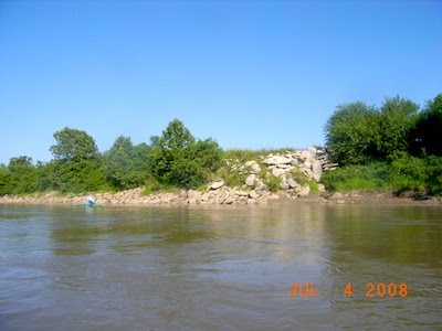
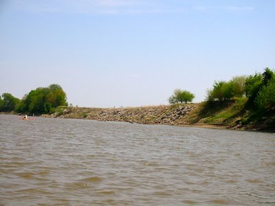
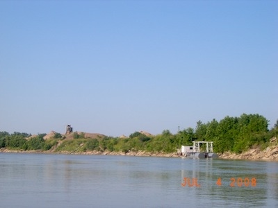
This permit is owned by Master’s Dredging Co., Inc. (formerly Kaw Sand  Company) and is located just up river from the entrance of Mud Creek about 5 miles east of Lawrence and is pictured on right. This site has been actively dredged for many years as can be evidenced by the poor condition of the south bank up stream from this dredge site. Because in-river dredging activity can cause head cutting and unstable banks, concrete rubble rip rap is placed to stabilize the banks near the operation (see below left.) Friends of the Kaw has also witnessed tailings from concrete trucks deposited on and down the bank in this area – broken up concrete or concrete rubble is used for bank stabilization but intact tailings are not legal fill (see below right.) Master’s Dredging Co., Inc. recently dredged the the channel south of the island and the sand bar shown in the Google Map above is gone. For aesthetic reasons, quarried rock is preferred for bank stabilization purposes. (See Google Map above)
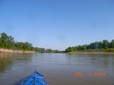
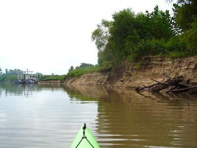
In the fall of 2009 Friends of the Kaw was alerted by a member that Master’s Dredging Company had moved their dredge down river in the channel south of the island. A beautiful sandbar that we had camped on was gone. Pictured below on the left is a picture taken of this area in 2008 and on the right is a picture of the dredge and a cut bank. Friends of the Kaw reported this situation to the Corps of Engineers.
