Wyandotte County and Kansas City Unified Government website
County Population: 155,509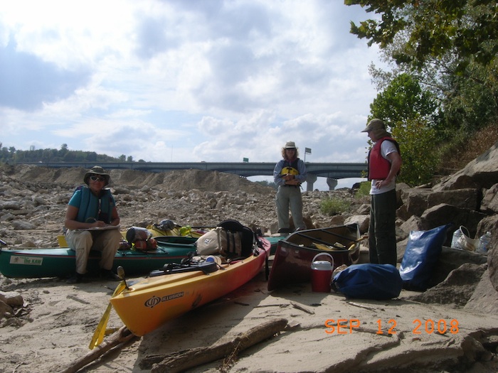
Area: 151 square miles
Population density: 1,030 per sq mi
County History
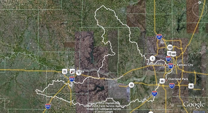
Detailed information from the River Inventory is available for
Western Wyandotte County and Eastern Wyandotte County
Kansas River Inventory – Western Wyandotte County
View Kansas River Inventory-Western Wyandotte County in a larger map. Click for map help.
Kansas River Inventory- Eastern Wyandotte County
View Kansas River Inventory-Eastern Wyandotte County in a larger map. Click for map help.
Bonner Springs – River Mile 21
Bonner Springs government website
Population size: 7,069
Square miles: 15.8
Population density: 447 people per sq mi
Watershed: Lower Kansas River HUC number 10270104
Lower Kansas River HUC 10270104
Boat access points: Edwardsville access
Bridges over Kaw: K-7
Wastewater treatment: Bonner Springs WWTP (Pop. served: 7,095)
Water source: Groundwater from 5 wells located along the north bank of the Kansas River, and purchased water from Kansas City, KS (more information)
In-river dredges permits: HSG Acquisition Co., LLC (formerly Holliday Sand and Gravel) river dredges at river mile 21 – 22 (active), 20.35 – 20.6 (active) and 18.65 – 20.15 (in active.)
Pit mines: HSB Acquisition Co, LLC at 21900 West 43rd Street (partially in Johnson County)
Edwardsville – River Mile 17
Edwardsville government website
Population size: 4,463
Square miles: 8.99
Population density: 496 people per sq mi
Watershed: Lower Kansas River HUC number 10270104
Boat access points: Edwardsville City Access park
Bridges over Kaw: I-435
Wastewater treatment: Kansas City WWTP #20 (Pop. served: 26,550)
Water source: Surface water from the Kansas River, and purchased water from Kansas City, KS.
Dredge sites/off river pit mines: The Kaw Valley Companies river dredge river mile18.4 – 19.9 (active.) There are no pit mines near the Kaw in this area.
Water Discharge Permits
Click on map markers for data from EPA MyEnvironment
Kansas City, Kansas – River Mile 17-1
Population size: 146,866
Square miles: 127.8 (3.5 sq mi of water)
Population density: 1,149 people per sq mi
Watershed: Lower Kansas River HUC number 10270104
Boat access points: Kaw point- Lewis and Clark Historical Park
Bridges over Kaw: I- 435, Turner Bridge of Kaw Dr., I-635, Kaw Dr., US 69/18th St., 12th St., 7th St., Kansas Ave., I-670, Central Ave., James St., and I-70.
Wastewater treatment: Kansas City Kansas WWTP #20 (Pop. served: 26,550); Kansas City Kansas WWTP #14 (Pop. served: 1,066); Kaw Point WWTP (Pop. served: 107,796)
Dredge sites/off river pit mines: Kaw Valley Companies in-river dredge permit at river mile 12.8 – 13.9 (active) and 9.4 – 10.4 (in active) and pit mine at 84th & Gibbs.
Water Discharge Permits
Click on map markers for data from EPA MyEnvironment